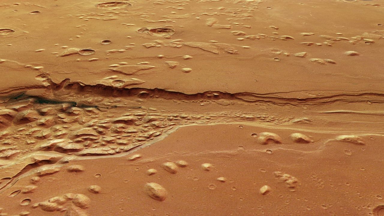
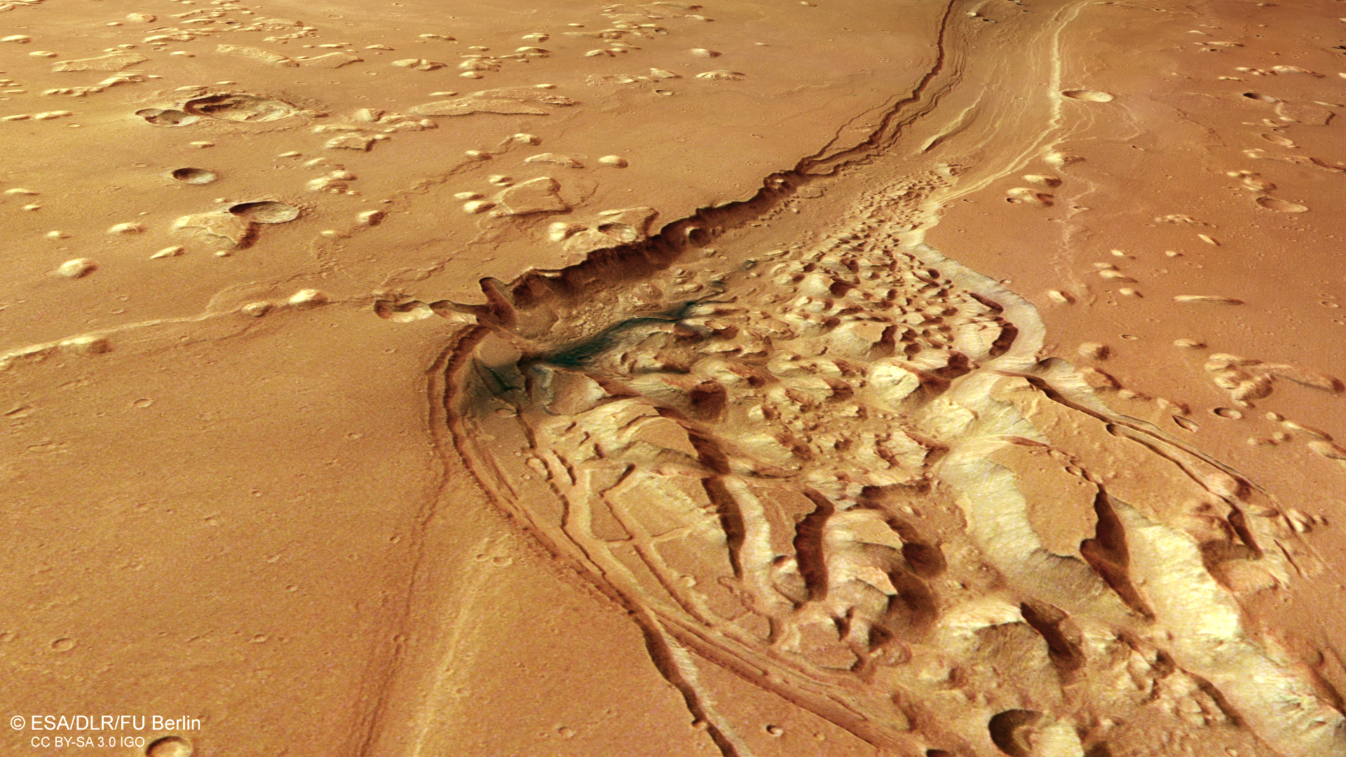
 A a bird's-eye view of part of Shalbatana Vallis, a large channel near the Red Planet's equator, as seen by the Mars Express orbiter. (Image credit: ESA/DLR/FU Berlin) Share this article 0 Join the conversation Add us as a preferred source on Google Newsletter Subscribe to our newsletter
 Stunning new images from Europe's Mars Express orbiter reveal a rugged Martian landscape carved by catastrophic floods that once tore across the Red Planet billions of years ago.
The dramatic new view, released by the European Space Agency (ESA) on May 13, spotlights Shalbatana Vallis, a sprawling Martian channel system near the planet's equator that stretches roughly 800 miles (1,300 kilometers, or about the length of Italy. The image was taken by Mars Express' High Resolution Stereo Camera (HRSC), highlighting what planetary scientists call "chaotic terrain," according to a statement from the space agency.
"This kind of terrain is common on Mars, and has been captured before by Mars Express," ESA officials said in the statement.
Researchers believe huge quantities of groundwater likely burst onto the surface in a series of catastrophic floods that surged downhill and rapidly carved the waterworn valleys visible today. The main channel seen in the images measures about 6 miles (10 kilometers) wide and plunges roughly 1,640 feet (500 meters) deep.
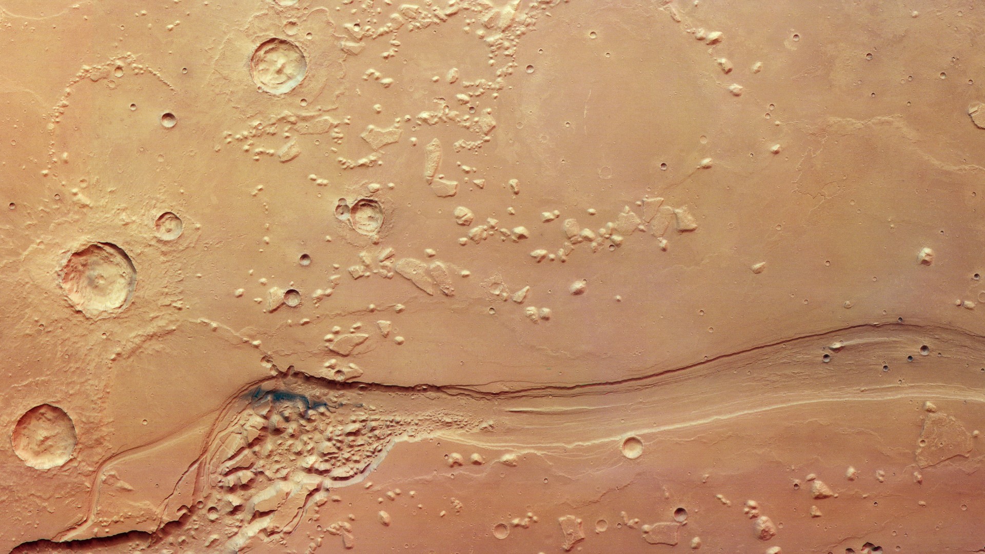
The recent images also reveal layers of Mars' complex geological past across the region, suggesting Shalbatana Vallis may once have been even deeper before gradually filling in with sediments, ash and other material over time. Dark blue-black deposits scattered through the valley are thought to be volcanic ash redistributed by Martian winds, while impact craters, wrinkle ridges and isolated mesas point to repeated cycles of catastrophic flooding, lava flows and erosion spanning billions of years.
Scientists are especially interested in regions like Shalbatana Vallis because they preserve evidence that Mars was once far warmer and wetter than it is today. The channel empties toward Chryse Planitia, one of the lowest regions on Mars, where some researchers have proposed an ancient ocean may once have existed, according to the statement.
Launched in 2003, Mars Express remains one of the longest-running missions still operating at Mars, with its HRSC mapping the Red Planet in color and 3D for more than two decades. Over the course of its mission, the spacecraft has played a major role in uncovering evidence of Mars' watery past, mapping minerals formed in water, studying buried ice deposits and even contributing to controversial findings suggesting possible liquid water beneath the planet's southern polar ice cap.
View MoreYou must confirm your public display name before commenting
Please logout and then login again, you will then be prompted to enter your display name.
Logout Samantha MathewsonContributing Writer
Samantha Mathewson joined Space.com as an intern in the summer of 2016. She received a B.A. in Journalism and Environmental Science at the University of New Haven, in Connecticut. Previously, her work has been published in Nature World News. When not writing or reading about science, Samantha enjoys traveling to new places and taking photos! You can follow her on Twitter @Sam_Ashley13.