Breaking space news, the latest updates on rocket launches, skywatching events and more!
Contact me with news and offers from other Future brands Receive email from us on behalf of our trusted partners or sponsors By submitting your information you agree to the Terms & Conditions and Privacy Policy and are aged 16 or over.You are now subscribed
Your newsletter sign-up was successful
Want to add more newsletters?
An account already exists for this email address, please log in. Subscribe to our newsletter 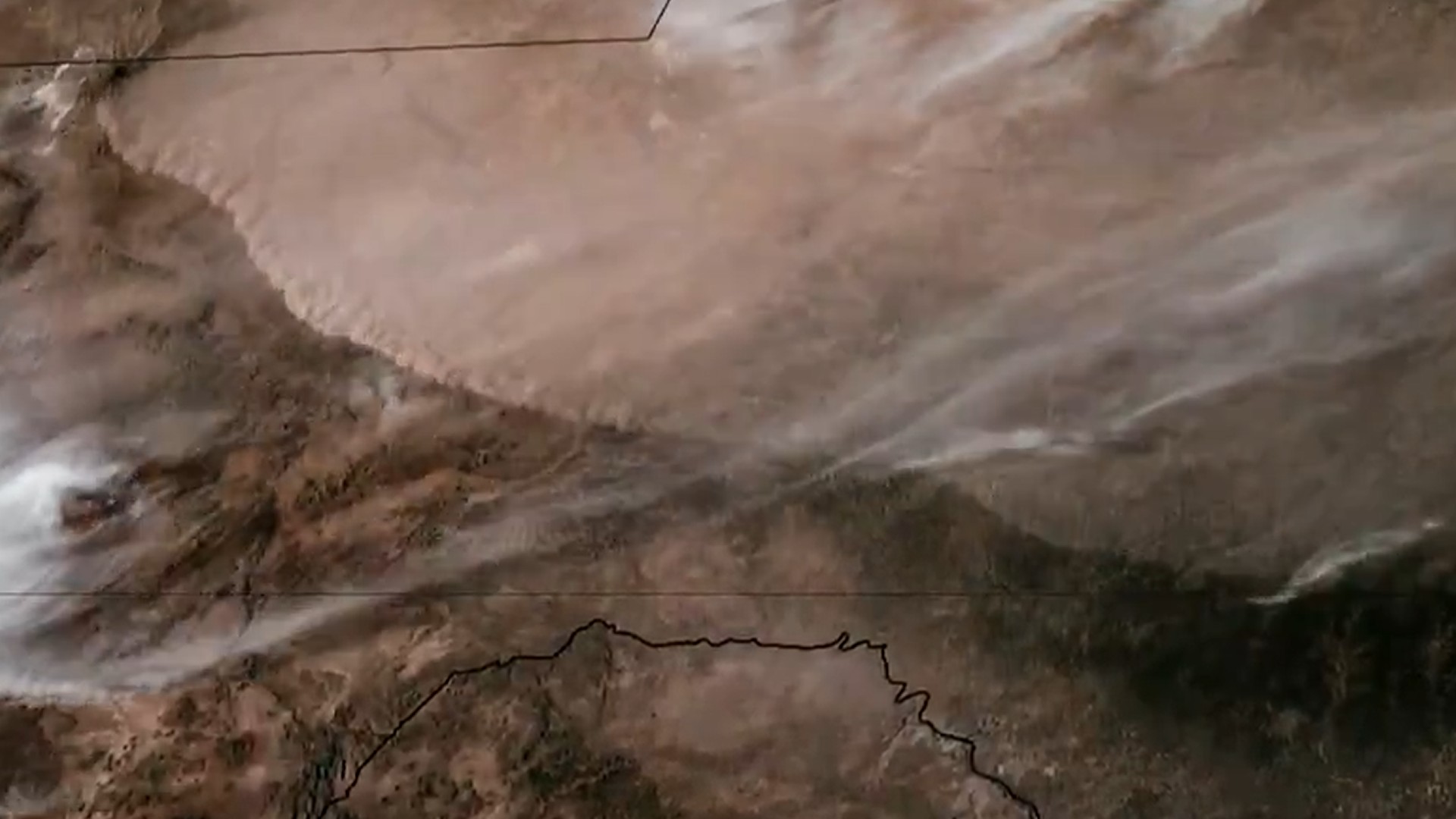
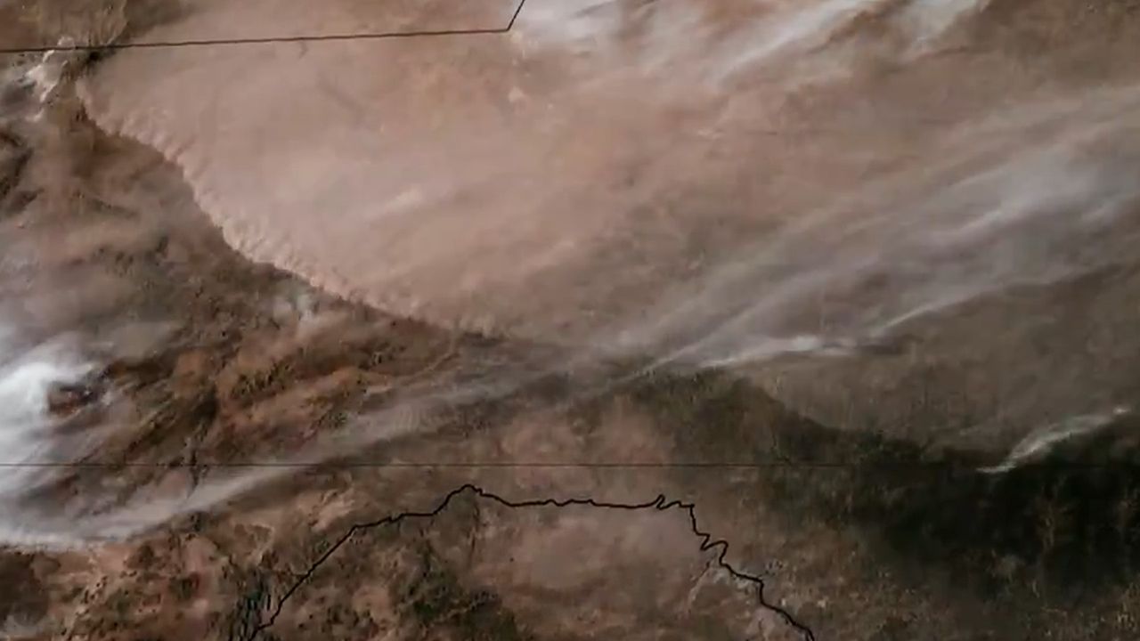
Incredible satellite imagery shows a wall of dust being blown through Texas as a cold front pushed its way across the United States on Monday (March 16).
What is it?
The footage was captured by the GOES-19 weather satellite operated by the National Oceanic and Atmospheric Administration (NOAA). It shows a line of dust being driven southward, far below clouds much higher in the atmosphere blowing from west to east.
The wall of dust was blown across West Texas by a cold front that brought extreme winter weather to much of the United States from March 14 to 16. The storm, known as Winter Storm Iona, brought record snowfall totals to the Midwest and damaging winds and tornadoes throughout the southern U.S.
Article continues belowSpectacular imagery of a wall of dust racing south through West Texas along a cold front yesterday. pic.twitter.com/4mjJlzckC0March 16, 2026
The dust storm created travel complications and other issues for Texans. At least one multi-vehicle pileup was reported due to the blinding dust sweeping across the state.
Why is it amazing?
It's rare to see such a pronounced line of dust visible from space. Colorado State University's Cooperative Institute for Research in the Atmosphere (CIRA) described the imagery as "spectacular" in a post on X.
Views of Earth like this one are are only made possible by NOAA's fleet of next-generation satellites. GOES 19 launched in June 2024 carrying what NOAA describes as "the most sophisticated technology ever flown in space to help forecast weather on Earth." The satellite has even captured images of solar eclipses, thanks to special sun-watching instruments aboard the spacecraft.
Get the Space.com NewsletterContact me with news and offers from other Future brandsReceive email from us on behalf of our trusted partners or sponsors Brett TingleyManaging Editor, Space.com
Brett is curious about emerging aerospace technologies, alternative launch concepts, military space developments and uncrewed aircraft systems. Brett's work has appeared on Scientific American, The War Zone, Popular Science, the History Channel, Science Discovery and more. Brett has degrees from Clemson University and the University of North Carolina at Charlotte. In his free time, Brett enjoys skywatching throughout the dark skies of the Appalachian mountains.
View MoreYou must confirm your public display name before commenting
Please logout and then login again, you will then be prompted to enter your display name.
Logout MORE FROM SPACE... 1Ryugu asteroid sample contains all five key components of DNA, scientists find
- 2SpaceX launches 10,000th active Starlink satellite in low Earth orbit
- 3Rare daytime fireball spotted from orbit as residents report powerful sonic boom
- 4Satellite watches wall of dust roll through Texas | Space photo of the day for March 17, 2026
- 5NASA will roll Artemis 2 moon rocket back to the launch pad on March 20