 This eye-catching space snap shows five brightly colored ephemeral lakes that emerged around the edge of Namibia's Etosha Pan when a pair of rivers flooded in 2011. (Image credit: NASA/ISS program) Share this article 0 Join the conversation Follow us Add us as a preferred source on Google Newsletter Get the Live Science Newsletter
 Get the world’s most fascinating discoveries delivered straight to your inbox.
Become a Member in Seconds
Unlock instant access to exclusive member features.
Contact me with news and offers from other Future brands Receive email from us on behalf of our trusted partners or sponsors By submitting your information you agree to the Terms & Conditions and Privacy Policy and are aged 16 or over.You are now subscribed
Your newsletter sign-up was successful
Want to add more newsletters?
Join the club
Get full access to premium articles, exclusive features and a growing list of member rewards.
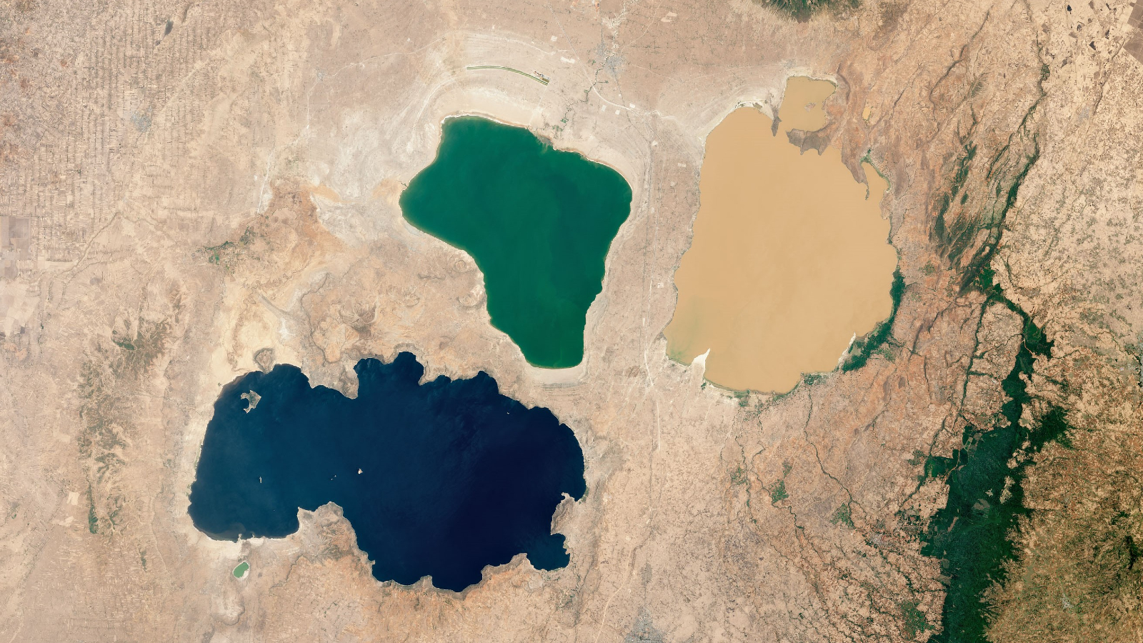
Explore An account already exists for this email address, please log in. Subscribe to our newsletter QUICK FACTSWhere is it? Etosha Pan, Namibia [-18.5946865, 16.04684972]
What's in the photo? A series of colorful, ephemeral lakes that appeared after a flooding event
Who took the photo? An unnamed astronaut on board the International Space Station (ISS)
When was it taken? Dec. 30, 2011
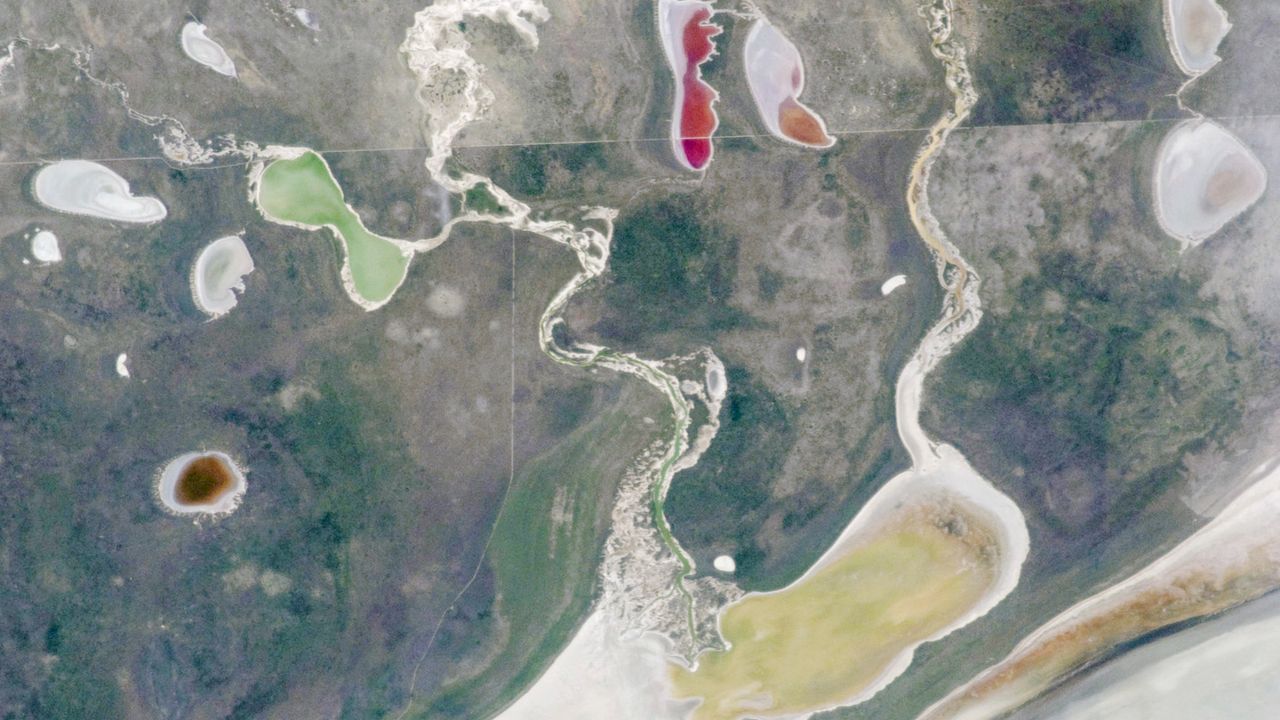
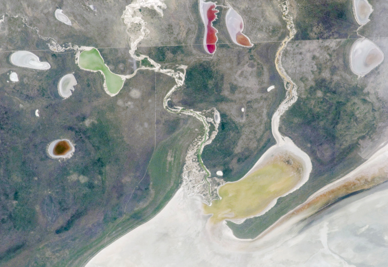
This intriguing astronaut photo shows off the contrasting colors of five ephemeral lakes that emerged around the edges of a giant salt pan after a major flooding event in southwest Africa.
The kaleidoscopic scene occurred in the northwest corner of the Etosha Pan — Africa's largest salt flat, or mineral pan, which covers around 1,800 square miles (4,730 square kilometers) in northern Namibia. The name Etosha roughly translates to "Great White Place" in an Indigenous Namibian language, and the ghostly expanse is located roughly 250 miles (400 kilometers) from the country's capital, Windhoek.
The satellite photo shows a snaking pair of ephemeral rivers that drain into the Etosha Pan: the Ekuma River (left) and the Oshigambo River (right). These winding waterways are surrounded by roughly a dozen bowl-like depressions that occasionally fill with water when the rivers sporadically flood their banks.
Article continues belowWhen the image was taken, both rivers had recently flooded due to heavy rains in the region, causing around half of these pale depressions to fill with water. The rest of the lakes remained empty and are the same pale hue as the rest of the Etosha Pan.
The contrasting colors of the newly filled lakes — which include yellow, green, brown, red and pink — are likely the result of different species of algae that bloomed within their shallow waters, according to NASA's Earth Observatory. (For scale, the green lake is around 4 miles (6.5 km) long at its widest point.)
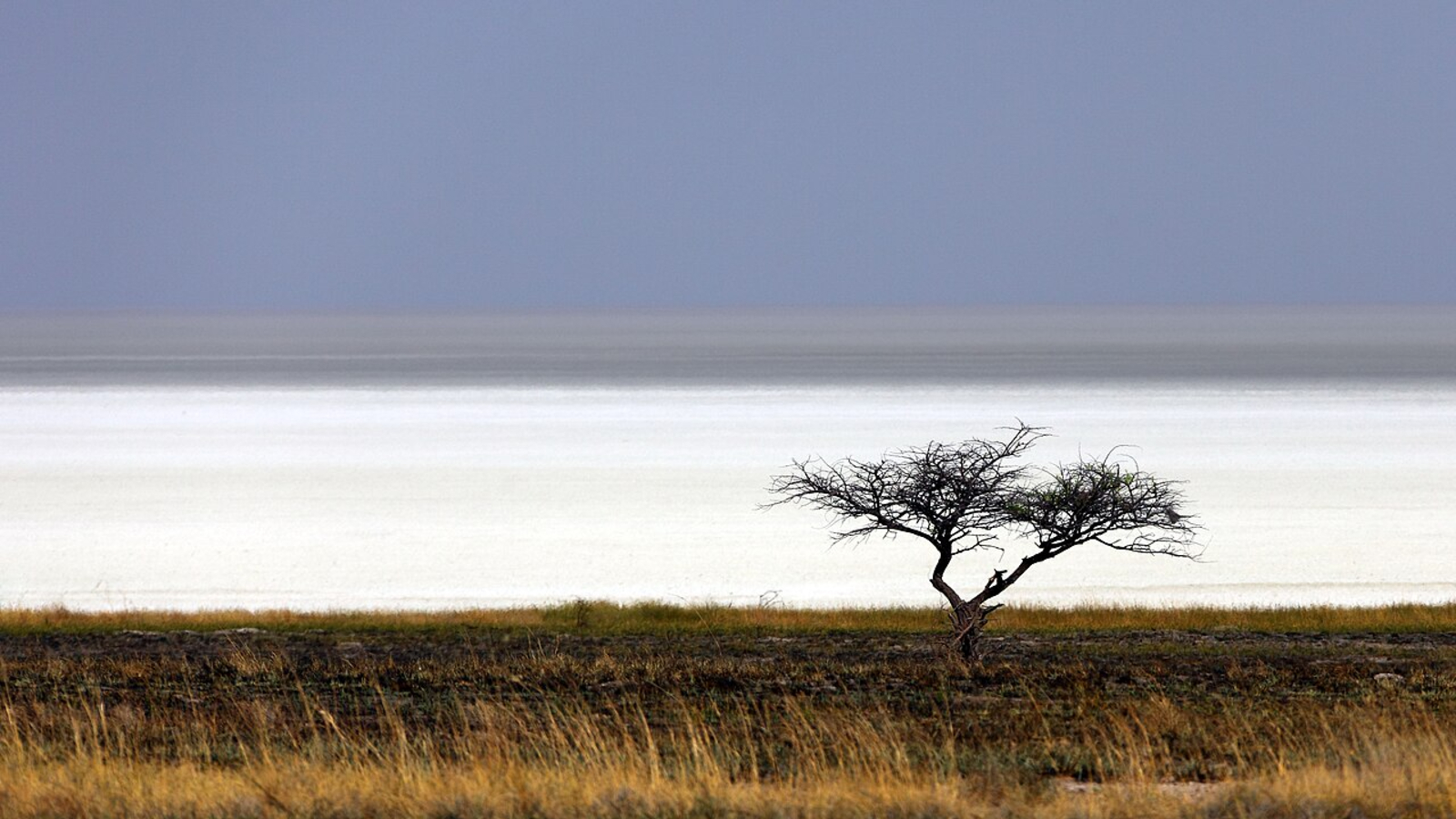
The Etosha Pan likely formed around 10 million years ago and has been a freshwater lake for most of that time. But around 16,000 years ago, toward the end of the last ice age, tectonic activity diverted one of the major rivers that fed into the lake, causing it to dry out.
As the water slowly evaporated, it left behind a thick layer of minerals, which covered the lake bed. Most of the pan's surface is covered by honeycomb-like hexagonal structures that are common among salt flats across the globe.
Sign up for the Live Science daily newsletter nowContact me with news and offers from other Future brandsReceive email from us on behalf of our trusted partners or sponsorsDuring flooding events, a thin layer of water can briefly lie within the pan, transforming it back into a shallow lake. However, this rarely happens, even when its rivers flood.
The last time a majority of the pan flooded was in 2006, which was also captured from space by ISS astronauts.
Wildlife haven
Despite the Etosha Pan's extreme dryness and salinity, which make it largely inhospitable to life, the area surrounding the ancient lake is covered with rich grassland and woodland.
This diverse ecosystem is protected as part of Etosha National Park, which covers 8,900 square miles (23,000 square km), and is home to a variety of animals, including lions, giraffes, zebras, hyenas, impalas, elephants, rhinos, springboks, wildebeests and ostriches, according to iNaturalist.
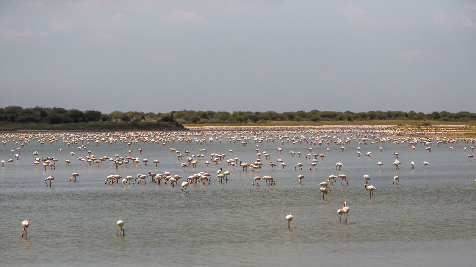
The salt flats themselves are also an important breeding site for flamingos, and up to 1 million of the pink birds congregate there at a time, according to the Etosha National Park website.
If you look closely at the astronaut photo, you can see the park's northern fence running across the image from left to right — just above the green lake and bisecting the red and pink lakes. This 10-foot-tall (3 meters) barrier stops the park's animals from wandering outside the woodlands where they could be targeted by poachers, according to the Earth Observatory.
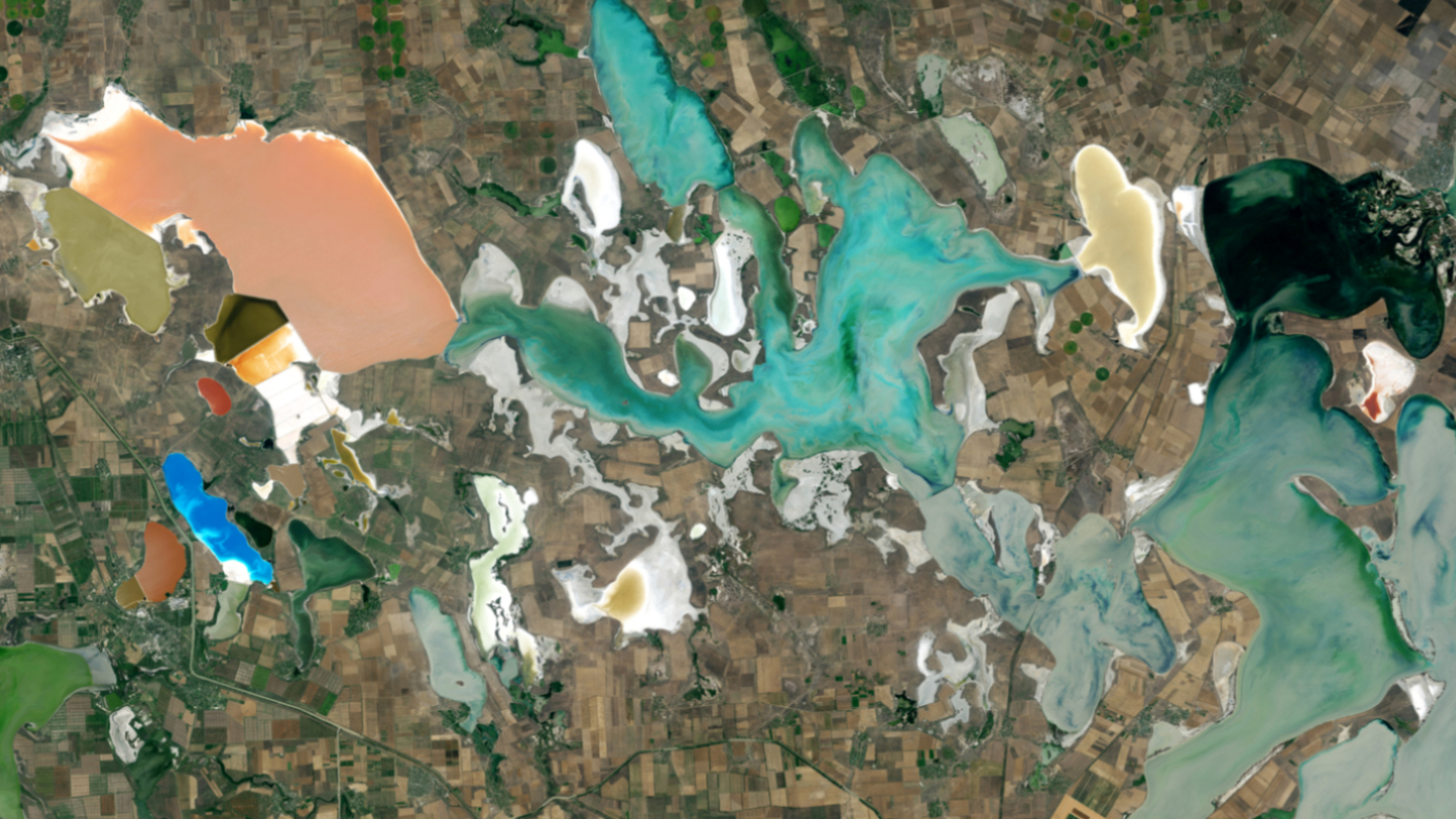
 Trio of multicolor African lakes
A 2023 satellite photo shows three closely grouped lakes in Ethiopia's Great Rift Valley. They have distinctly different hues thanks to a combination of biological and geological factors.
 Rainbow-colored 'putrid sea' in Crimea
A 2014 satellite photo of the Sivash region shows off the kaleidoscopic colors of a series of shallow, hypersaline lagoons — each filled with a different kind of algae.
 Iraq's multicolor 'sea of salt'
A 2024 astronaut photo shows off the striking contrasting colors of Iraq's Razazah Lake, which is surrounded by a host of strange "crop circles."
TOPICS Harry BakerSenior Staff Writer
Harry is a U.K.-based senior staff writer at Live Science. He studied marine biology at the University of Exeter before training to become a journalist. He covers a wide range of topics including space exploration, planetary science, space weather, climate change, animal behavior and paleontology. His recent work on the solar maximum won "best space submission" at the 2024 Aerospace Media Awards and was shortlisted in the "top scoop" category at the NCTJ Awards for Excellence in 2023. He also writes Live Science's weekly Earth from space series.
View MoreYou must confirm your public display name before commenting
Please logout and then login again, you will then be prompted to enter your display name.
Logout LATEST ARTICLES 1'Super El Niño' could push global temperatures to unprecedented highs, forecasters say
- 2How plants moved from sea to land and changed Earth forever
- 3A single injection of mRNA-like treatment could help heart muscle heal after a heart attack in mice and pigs. Could it work in humans too?
- 4El Niño: Facts, news, features and articles about the climate cycle that impacts weather patterns around the globe
- 5Live Science Today: 'Hexagonal' diamonds and fish scale down