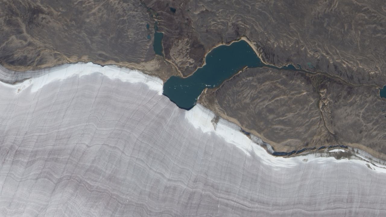
 This 2010 satellite photo shows the point where the diminutive Gee Lake intersects with the ancient, stripy gray ice the Barnes Ice Cap. (Image credit: NASA/EO-1) Share this article 0 Join the conversation Follow us Add us as a preferred source on Google Newsletter Sign up for the Live Science daily newsletter now
 Get the world’s most fascinating discoveries delivered straight to your inbox.
Become a Member in Seconds
Unlock instant access to exclusive member features.
Contact me with news and offers from other Future brands Receive email from us on behalf of our trusted partners or sponsors By submitting your information you agree to the Terms & Conditions and Privacy Policy and are aged 16 or over.You are now subscribed
Your newsletter sign-up was successful
Want to add more newsletters?
Join the club
Get full access to premium articles, exclusive features and a growing list of member rewards.
Explore An account already exists for this email address, please log in. Subscribe to our newsletter QUICK FACTSWhere is it? Barnes Ice Cap, Baffin Island, Canada [69.8543969, -72.30088281]
What's in the photo? A lake bisecting the snowy rim of an ancient glacier
Which satellite took the photo? NASA's Earth Observing-1 (EO-1) satellite
When was it taken? Sept. 4, 2010
This striking satellite photo shows the point where a tiny lake bisects the snowy rim of a massive ancient glacier on a Canadian island in the Arctic Circle.
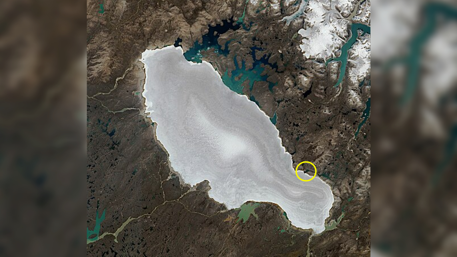
The small body of water, dubbed Gee Lake, is around 2 miles (3.2 kilometers) across at its widest point. It is located along the edge of the southeast limb of the Barnes Ice Cap — a roughly 2,300-square-mile (6,000 square kilometers), "bowling-pin-shaped" glacier situated at the center of Baffin Island in Canada's Nunavut territory.
In this image, captured in early September 2010, both the lake and the ice cap are still snow-free, except for the ice cap's edge, due to warmer summer temperatures. As a result, we can see the dark gray of the glacier, which is caused by the buildup of dust between layers of ice "spanning time periods that dwarf a human life," according to NASA's Earth Observatory. (In the winter, the glacier, lake and surrounding landscape are blanketed with snow.)
The exposed ice, which is up to 1,600 feet (500 meters) thick, is marked with striations that look like the "growth lines on a clamshell" running east to west, Earth Observatory representatives wrote.
These grooves are ridges cut by meltwater streams running off the glacier, Ted Scambos, a glaciologist at the University of Colorado Boulder and the National Snow and Ice Data Center, told the Earth Observatory. And while they give the impression that the ice is undulating, the surface of the glacier is surprisingly flat and smooth, he added.
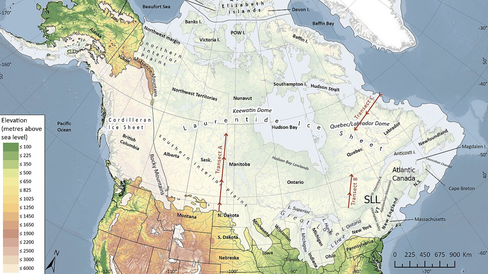
Ice core samples collected from the glacier reveal that parts of the Barnes Ice Cap date back around 20,000 years, making it Canada's oldest known ice, according to a 2008 study. It is also the last remaining fragment of the Laurentide Ice Sheet, which covered most of Canada and the northern U.S. as far back as 100,000 years ago and helped to carve out the Great Lakes.
By around 20,000 years ago, as the last ice age began to thaw, most of the Laurentide Ice Sheet had melted away. But what was left slowly migrated north, toward what is now Baffin Island, where it eventually disappeared into the sea (aside from the Barnes Ice Cap). A 2009 study revealed that most of the melting ice passed through the Kangiqtualuk Uqquqti Fjord (previously known as the Sam Ford Fjord), around 70 miles (110 km) northeast of Gee Lake.
Sign up for the Live Science daily newsletter nowContact me with news and offers from other Future brandsReceive email from us on behalf of our trusted partners or sponsorsAlthough most of the Laurentide Ice Sheet is long gone, we can still see its impacts today. Recent research has shown that its meltwater has significantly altered ocean currents, while the geological "rebound" caused by the vanished weight that once pressed down on North America may be causing some major U.S. cities to sink and also affecting parts of Greenland.
Like most other glaciers in the Arctic and Antarctica, the Barnes Ice Cap is shrinking as a result of rising temperatures from human-caused climate change.
Although its current rate of ice loss is minimal — just a few meters of retreat per year — this will increase sharply as temperatures rise further. A 2017 study predicts that most of the glacier will "likely disappear in the next 300 years."
See more Earth from space
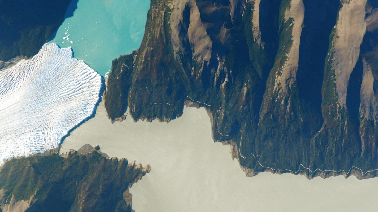 Glacier, lake and river 'touch'
A 2021 astronaut photo shows a triple valley system in Argentina's Los Glaciares National Park where a massive climate-resilient glacier, a pristine turquoise lake and a murky green "river" come together at a single point.
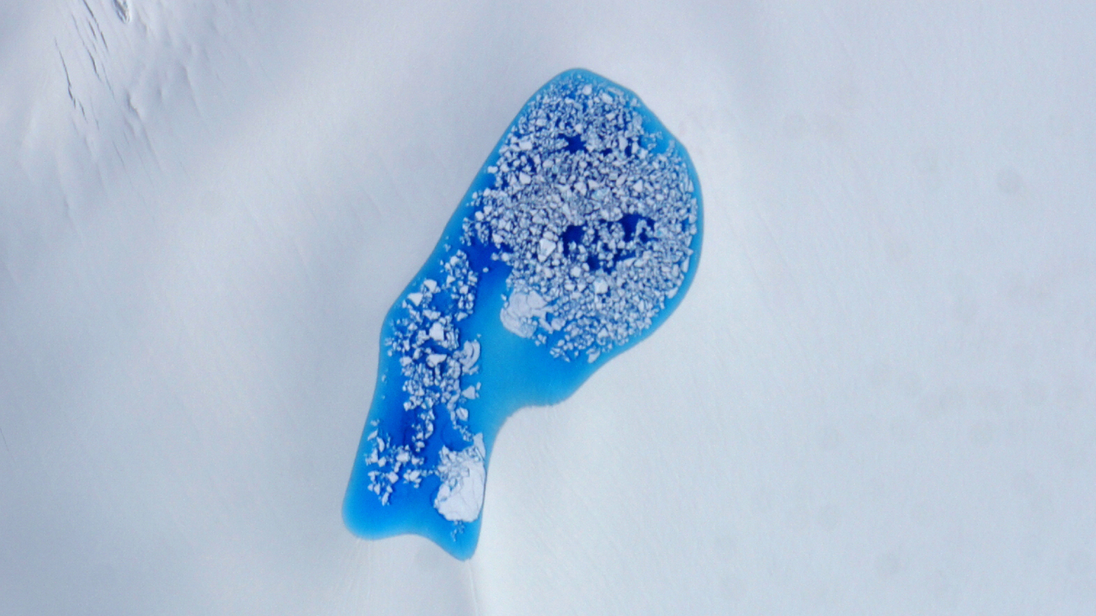 Massive blue 'melt pond' in Arctic
A 2014 photo shows a massive, iceberg-littered pool of vibrant blue meltwater sitting alone on top of a glacier in Alaska. Similar "melt ponds" are becoming increasingly common in the Arctic due to climate change.
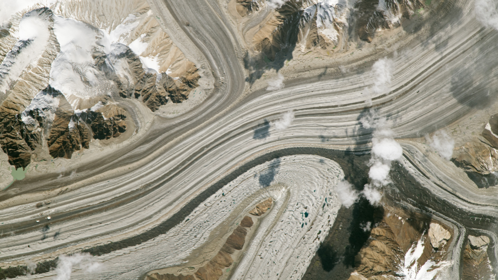 Trio of glaciers defy expectations
A 2023 astronaut photo shows three glaciers merging into a single massive ice mass in the Karakoram mountains. The stripy glaciers have gained ice in recent decades, despite the effects of human-caused climate change.
TOPICS Harry BakerSenior Staff Writer
Harry is a U.K.-based senior staff writer at Live Science. He studied marine biology at the University of Exeter before training to become a journalist. He covers a wide range of topics including space exploration, planetary science, space weather, climate change, animal behavior and paleontology. His recent work on the solar maximum won "best space submission" at the 2024 Aerospace Media Awards and was shortlisted in the "top scoop" category at the NCTJ Awards for Excellence in 2023. He also writes Live Science's weekly Earth from space series.
View MoreYou must confirm your public display name before commenting
Please logout and then login again, you will then be prompted to enter your display name.
Logout LATEST ARTICLES 1Stone Age tombs in Scotland reveal 'webs of descent' among male relatives
- 2'Oslo patient' likely cured of HIV after getting stem cell transplant from his brother, who is genetically resistant to the virus
- 3Antiseptic-tolerant germs spread through the air in hospitals, early study hints
- 4Homo erectus' tools include stunning geodes and fossils, possibly as a way to connect with the cosmos, study finds
- 5Physicists entangle two moving atoms for the first time, validating 'spooky' quantum theory