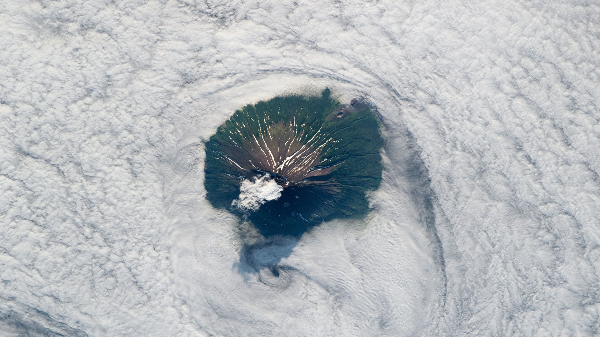
Where is it? Atlasov Island, off the coast of Russia's Kamchatka Peninsula [50.84755357, 155.56126752]
What's in the photo? The summit of Alaid volcano peeking above a thick layer of low-lying clouds
Who took the photo? An unnamed astronaut on board the International Space Station
When was it taken? Aug. 2, 2019
This eye-catching astronaut photo shows a towering, highly active Russian volcano poking its head above a thick bank of swirling clouds over the Kuril Islands.
The lofty peak is located on Atlasov Island, the northernmost of the Kuril Islands — a chain of roughly 50 largely uninhabited volcanic landmasses stretching along a fault line that runs between Russia and Japan in the Sea of Okhotsk. Altasov lies 40 miles (65 kilometers) off Russia's Kamchatka Peninsula, which is also renowned for its volcanic activity.
The island consists mainly of a single, massive volcano, called Alaid, which is known for its near-perfect cone shape. Alaid reaches up to 7,497 feet (2,285 meters) above sea level, making it the tallest peak in the Kuril Islands.
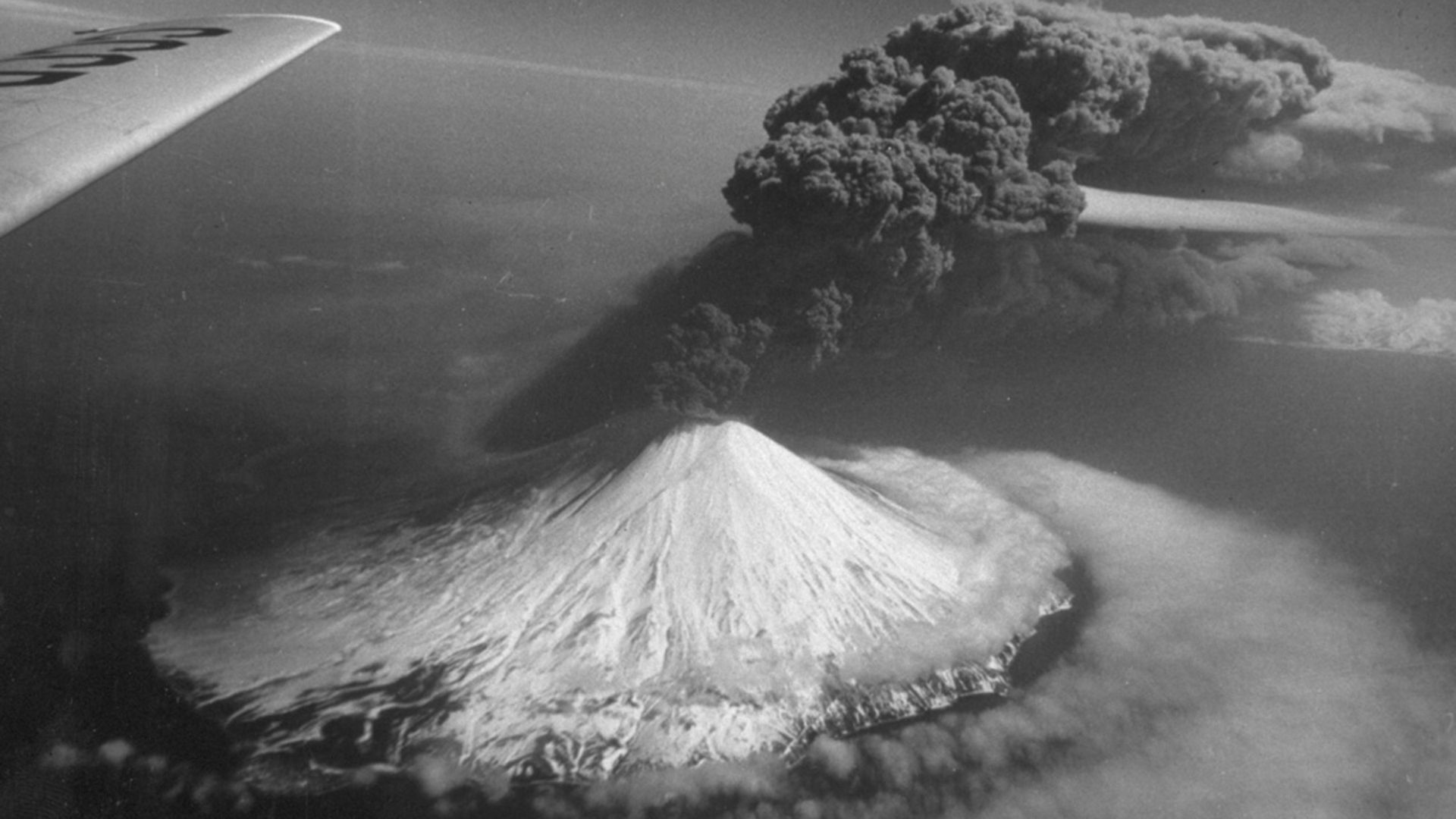
Alaid has erupted at least nine times in the past 50 years, including a major outburst in April 1981 that ejected a 1,250-mile-long (2,000 km) plume of thick smoke and ash into the atmosphere, according to the Smithsonian Institution's Global Volcanism Program.
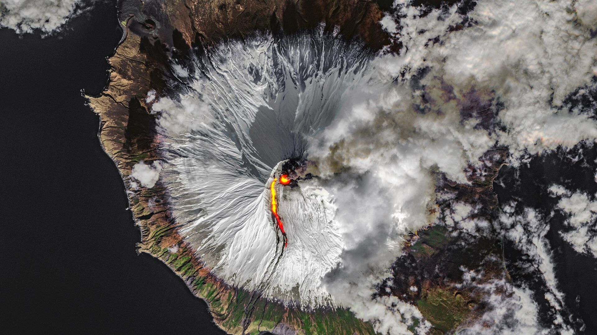
Its most recent eruption occurred between September and November 2022, when a river of lava flowed down its flank (see below). During this outburst, the volcano also spit out smoke and ash that was spotted from space alongside another eruption plume coming from the nearby island Paramushir.
In the astronaut's photo, roughly half of Atlasov Island rises above a deep, low-lying bank of swirling clouds. The summit of Alaid, crowned by a roughly mile-wide (1.6 km) caldera, is also obscured by clouds. (The volcano was not erupting when the photo was taken.)
Farther down the volcano's flanks are a series of snow-filled gullies carved out by lava flows from previous eruptions. Eagle-eyed viewers may also be able to spot some parasitic cones — small openings where lava burst through in the past — around the edge of the cloud layer, according to NASA's Earth Observatory.
The area surrounding a cluster of parasitic cones on the volcano's northwest flank (top right in the photo) is devoid of vegetation — a result of another major eruption in 1972, which scoured the surrounding landscape with hot ash. A 2009 study revealed fresh signs of recovery in the affected area, but noted that it could take hundreds of years for vegetation to return to pre-eruption levels.
The clouds are not the only thing the island rises above. Alaid is essentially the summit of a much larger underwater volcano that lies beneath the Sea of Okhotsk. The rest of the island has grown around the exposed cone as lava flows have reached sea level and solidified. Millions of years ago, this larger volcano was likely connected to the Kamchatka Peninsula via a land bridge that has since been submerged.
Astronauts and satellites have snapped several other stunning shots of intriguing landmasses nearby, including a quartet of end-to-end volcanoes on Simushir Island and a set of volcanic "nesting dolls" on Onekotan Island.
And in 2022, the Landsat 8 satellite also spotted the iconic summit of Mount Vesuvius peeking through a gap in the clouds over Italy, just like Alaid.
See more Earth from space
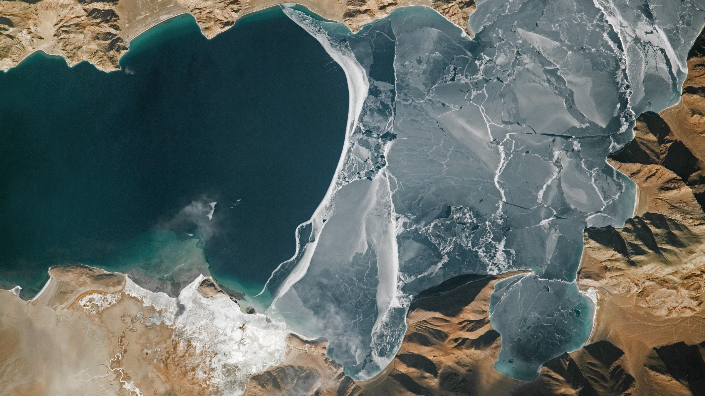
World's highest frozen lake shatters
A 2024 astronaut photo shows the icy surface of Pangong Lake breaking apart in the lofty Tibetan Plateau. The point where the ice meets the water almost perfectly matches a disputed border between China and India.
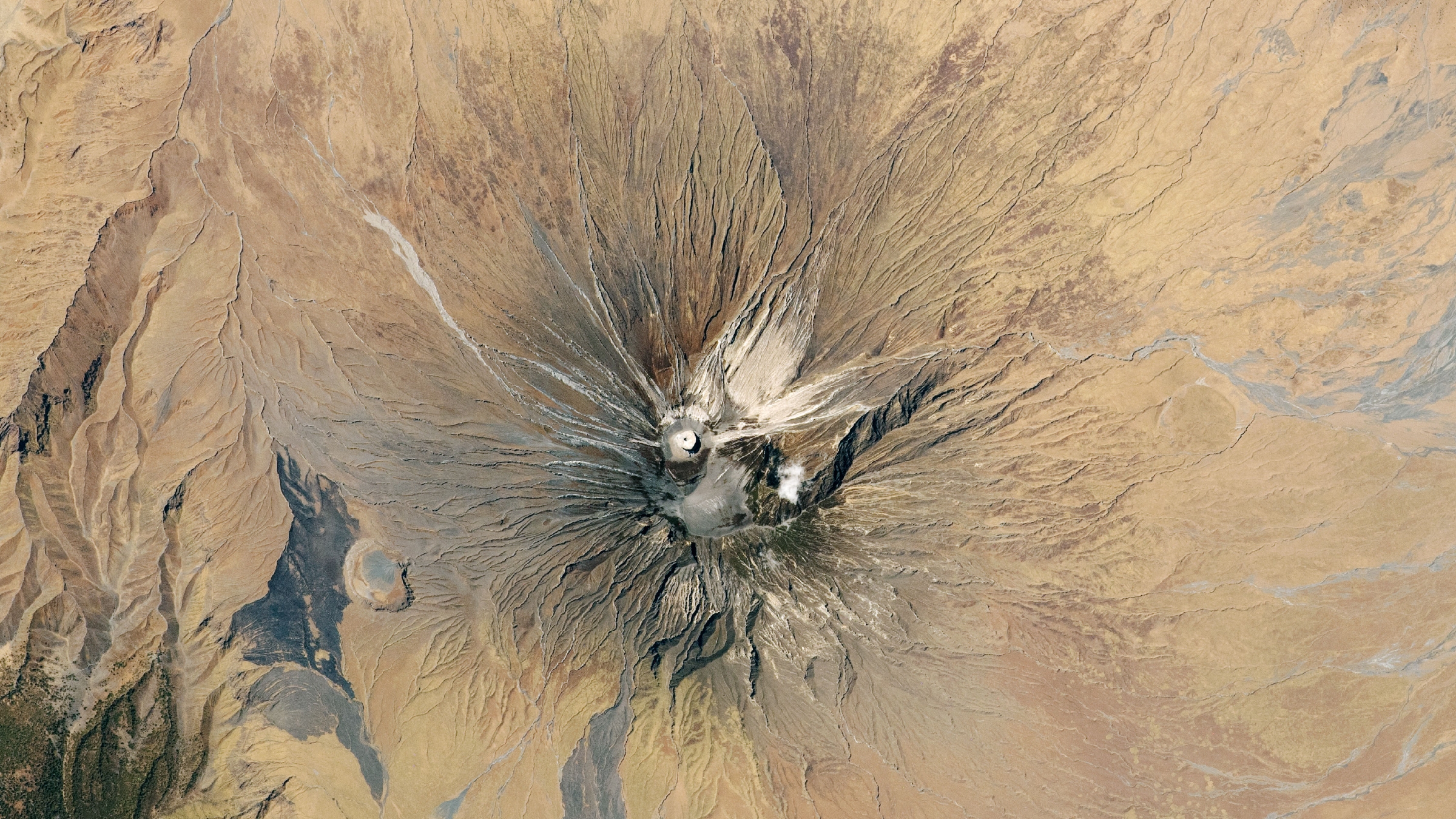
Explosive 'Mountain of God' looms
A 2020 astronaut photo shows the unique structure of Ol Doinyo Lengai, an active stratovolcano in Tanzania that was recently adorned with a bright white "ash cone." The explosive peak produces a rare type of lava that is unusually cool but travels remarkably quickly.
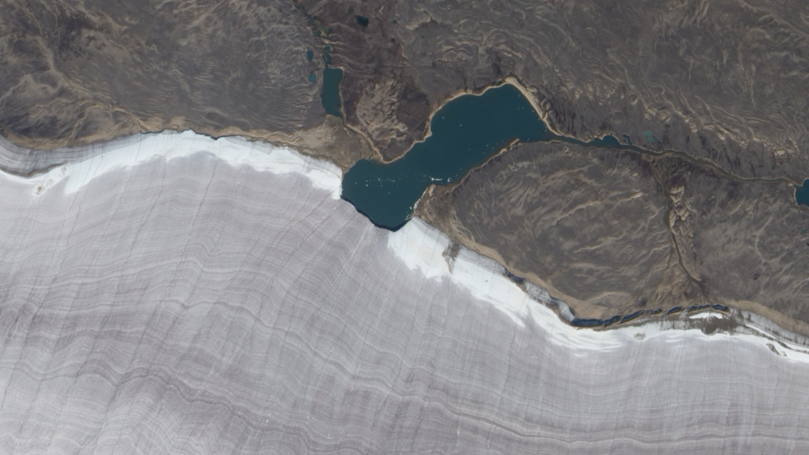
Mini lake meets ancient ice mass
A 2010 satellite photo shows the point where a small lake bisects the snowy rim of an ancient glacier on Canada's Baffin Island. The rippling, snow-rimmed structure is the last remaining fragment of a colossal ice sheet that once covered large parts of North America.